null Skip to main content

✨ Buy more, save 5% Ends

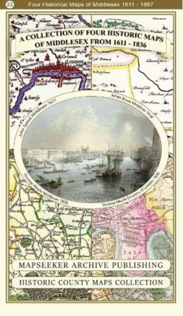
A Middlesex 1611 – 1836 – Fold Up Map that features a collection of Four Historic Maps, John Speed’s County Map 1611, Johan Blaeu’s County Map of 1648, Thomas Moules County Map of 1836 and a Map of the Environs of London 1836.

A Middlesex 1611 – 1836 – Fold Up Map that features a collection of Four Historic Maps, John Speed’s County Map 1611, Johan Blaeu’s County Map of 1648, Thomas Moules County Map of 1836 and a Map of the Environs of London 1836.

Was: $22.91
Now: $18.27
New condition
(No reviews yet) Write a Review
Physical book delivery

Shipping calculated at checkout.

Estimated delivery
Adding to cart… The item has been added
Product Details
Author:
Mapseeker Publishing Ltd.
Publisher:
Historical Images Ltd
Publication Date:
Jan 04, 2019
Binding:
Paperback / softback
ISBN-13:
9781844918454
ISBN10:
1844918459

Overview


  • | Author: Mapseeker Publishing Ltd.
  • | Publisher: Historical Images Ltd
  • | Publication Date: Jan 04, 2019
  • | Number of Pages:
  • | Language:
  • | Binding: Paperback / softback
  • | ISBN-13: 9781844918454
  • | ISBN-10: 1844918459

Reviews

0 Reviews

Write a Review

No reviews yet.

Share your experience and help another reader choose their next book.
Advertisement — clicking an ad will take you to the advertiser’s website.

Discover your next great book

Get new releases, reader favourites, and special offers delivered to your inbox.