null Skip to main content

✨ Buy more, save 5% Ends

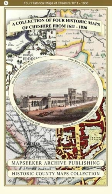
A Cheshire 1611 - 1840 - Fold Up Map that features a collection of Four Historic Maps, John Speed's County Map 1611, Johan Blaeu's County Map of 1648, Thomas Moules County Map of 1840 and Cole and Roper's Plan of the City of Chester 1805.

A Cheshire 1611 - 1840 - Fold Up Map that features a collection of Four Historic Maps, John Speed's County Map 1611, Johan Blaeu's County Map of 1648, Thomas Moules County Map of 1840 and Cole and Roper's Plan of the City of Chester 1805.

Was: £19.99
Now: £15.94
New condition
(No reviews yet) Write a Review
Physical book delivery

Shipping calculated at checkout.

Estimated delivery
Adding to cart… The item has been added
Product Details
Author:
NA
Publisher:
Historical Images Ltd
Publication Date:
Dec 12, 2018
Binding:
Paperback / softback
ISBN-13:
9781844918485
ISBN10:
1844918483

Overview


  • | Author: NA
  • | Publisher: Historical Images Ltd
  • | Publication Date: Dec 12, 2018
  • | Number of Pages:
  • | Language:
  • | Binding: Paperback / softback
  • | ISBN-13: 9781844918485
  • | ISBN-10: 1844918483

Reviews

0 Reviews

Write a Review

No reviews yet.

Share your experience and help another reader choose their next book.

Advertisement — clicking an ad will take you to the advertiser’s website.

Discover your next great book

Get new releases, reader favourites, and special offers delivered to your inbox.