null Skip to main content

✨ Buy more, save 5% Ends

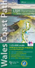
Isle of Anglesey Coast Path Map: 1:25,000 scale Ordnance Survey mapping for the entire Isle of Anglesey Coast Path

Isle of Anglesey Coast Path Map: 1:25,000 scale Ordnance Survey mapping for the entire Isle of Anglesey Coast Path

Was: £9.99
Now: £8.29
New condition
(No reviews yet) Write a Review
Physical book delivery

Shipping calculated at checkout.

Estimated delivery
Adding to cart… The item has been added
Product Details
Author:
NA
Publisher:
Northern Eye Books
Publication Date:
Nov 04, 2019
Binding:
Pamphlet
ISBN-13:
9781908632593
ISBN10:
1908632593

Overview

Enhanced, large scale (1: 25,000) Ordnance Survey mapping in a handy atlas format with all the mapping you need to walk a complete circuit of the Anglesey section of the Wales Coast Path. Continuous OS mapping covering the complete circuit from Menai Bridge. Contains coastal extracts from large scale Explorer maps 262 and 263.


  • | Author: NA
  • | Publisher: Northern Eye Books
  • | Publication Date: Nov 04, 2019
  • | Number of Pages:
  • | Language:
  • | Binding: Pamphlet
  • | ISBN-13: 9781908632593
  • | ISBN-10: 1908632593

Reviews

0 Reviews

Write a Review

No reviews yet.

Share your experience and help another reader choose their next book.

Discover your next great book

Get new releases, reader favourites, and special offers delivered to your inbox.