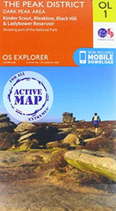
Peak District (Dark Peak): With Ordnance Survey Mapping
HarperCollins Publishers
£14.78
(No reviews yet)

Write a Review

HarperCollins Publishers
Peak District (Dark Peak): With Ordnance Survey Mapping
The A-Z Adventure Series uses Ordnance Survey mapping and is the perfect companion for walkers, off-road cyclists, and anyone wishing to explore the great outdoors.
The A-Z Adventure Series uses Ordnance Survey mapping and is the perfect companion for walkers, off-road cyclists, and anyone wishing to explore the great outdoors.This A-Z Adventure Atlas of the Peak District (Dark Peak) features 50 pages of continuous Ordnance Survey mapping covering:Peak District National Park (northern part)Kinder ScoutHope ValleyHathersageCastletonSnake PassDerwent ValleyThis National Trail Map features detailed mapping at a scale of 1:25 000, providing complete coverage of the Peak District (Dark Peak). Additional features include:Information CentresHotels/B&BsYouth HostelsCampsites (seasonal opening)Public HousesShopsRestaurantsCafes (seasonal opening)Petrol StationsOther books available in the A-Z Adventure series include: Pembrokeshire Coast Path, Peddars Way and Norfolk Coast Path, South Downs Way, Cotswold Way, South West Coast Path and The North Coast 500.
- | Author: A-Z Maps
- | Publisher: HarperCollins Publishers
- | Publication Date: Mar 27, 2025
- | Number of Pages:
- | Language:
- | Binding: Paperback / softback
- | ISBN-13: 9780008744205
- | ISBN-10: 0008744203
- Author:
- A-Z Maps
- Publisher:
- HarperCollins Publishers
- Publication Date:
- Mar 27, 2025
- Binding:
- Paperback / softback
- ISBN-13:
- 9780008744205
- ISBN10:
- 0008744203