Overview
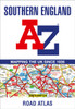
A full-colour, regional road atlas from A-Z Maps. Featuring more than 50 pages of continuous mapping of regions in the east of England.
A full-colour, regional road atlas from A-Z Maps. Featuring more than 50 pages of continuous mapping of regions in the east of England.Published at a clear 2.5 miles to 1 inch the following features are shown on the road mapping:Motorways with full junction detail, primary routes and destinations, A & B roads, under construction and proposed roads, service areas, tolls, mileages, county and unitary authority boundariesNational Park boundariesSelected places of interest and tourist information centresSeparate city, town, airport, and port plansThe comprehensive index section lists cities, towns, villages, hamlets and locations covered by this atlas.
- | Author: A-Z Maps
- | Publisher: HarperCollins Publishers
- | Publication Date: Jul 04, 2024
- | Number of Pages:
- | Language:
- | Binding: Paperback / softback
- | ISBN-13: 9780008652821
- | ISBN-10: 0008652821